Landscapes in Motion was built on the foundation of other powerful research efforts. There are several important research initiatives working to better understand the ways landscapes are shaped over time in western Canada, developing novel ways to approach these challenges in the field and using cutting-edge computer models. The leaders of these research efforts also led Landscapes in Motion, bringing their experience and expertise to the table in a powerful way.

Tree Ring Lab (UBC)
The Tree Ring Lab at UBC Forestry combines forest ecology with the study of tree rings to better understand how natural and human forces, as well as climate, have shaped forests in North and South America. Researchers with the Tree Ring Lab are out in the field, collecting samples and identifying plants, and they are also in the lab, painstakingly counting tree rings. The experience and techniques they bring to Landscapes in Motion will be instrumental in learning this landscape’s fire history.
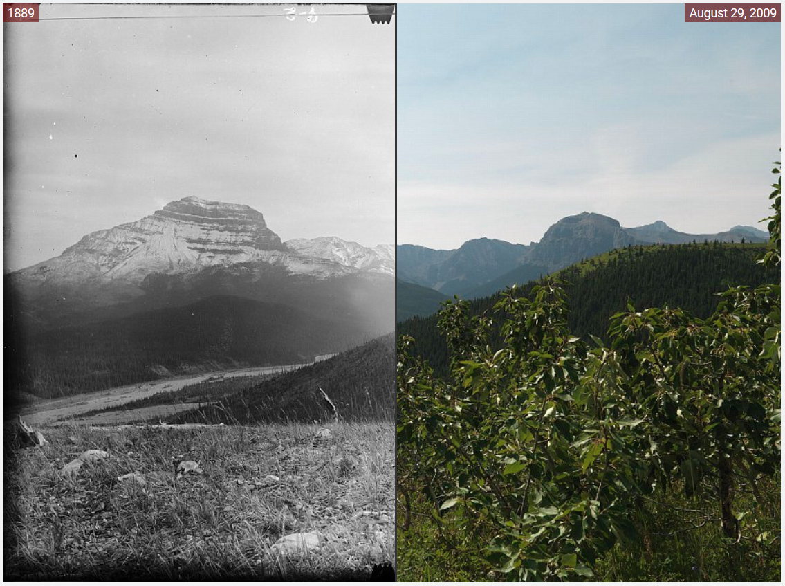
Mountain Legacy Project (University of Victoria)
Over 120,000 photos of the southern Rockies in Canada were taken by land surveyors between 1861 and 1958. For over fifteen years, the Mountain Legacy Project has sent researchers to capture over 6,000 photographs (and counting) of the same landscapes, taken from the exact same spot, from the exact same angle. Their team of researchers has developed innovative techniques for comparing these photos to determine how the vegetation has changed between then and now. The leader of the Mountain Legacy Project is also helping lead Landscapes in Motion.

SpaDES: Spatially Discrete Event Simulator (Canadian Forest Service)
Landscapes are made up of countless interrelated parts, which means it can be extremely challenging to understand how they all fit together. Climate, insect outbreaks, the shape of a landscape, the types and ages of plants… these elements and many others affect the way landscapes burn and how they grow back. Instead of starting from scratch, SpaDES allows us to benefit from work that has already been done, and to flesh the model out with the information we collect. SpaDES is being developed by scientists with the Pacific Forestry Centre of the Canadian Forest Service in collaboration with the Healthy Landscape Program of fRI Research in Alberta.
Landscapes in Motion would not be possible without the financial support provided by several organizations and agencies. Through their support, we are able to explore the role of wildfire in shaping the landscapes of the southern Rockies in new and exciting ways.