On-the-ground findings point to a mixed-severity fire regime: Findings of the Fire Regime Team
/Landscapes in Motion is a project to improve the understanding of how, where, and when wildfires have occurred through Alberta’s southern Rocky Mountains. In this piece we travel through the forest with the Fire Regime team and find out what they’ve learned about the historical fire regimes of the forests of the Alberta’s Eastern Slopes.
When you step into a forest, there are many things you may notice about it. Are the trees tall and broad or young and dense? Can you walk with ease across the open ground, or do you struggle through shrubs and thickets? Is it shady and cool or sunny and open? Do you stumble upon the occasional meadow or aspen woodland, or is it pine as far as the eye can see?
Many processes shape these characteristics of forest stands and landscapes over time. In western Canadian forests, disturbances like fire play an important role: they affect forest age, composition, and the mosaic of patches across the landscape. Our understanding of historical fire regimes also shapes how we manage them. And, much like the forest itself, the fire regimes of southwestern Alberta may be more complex than they appear at first glance. Gaining deeper insight into these fire regimes and how they have shaped the landscape was the goal at the heart of the Fire Regime team’s work.
Pursuing a deeper understanding of fire regimes
Forests in the southwestern Alberta Foothills have long been thought of as “fire-dominated” ecosystems with a high-severity fire regime, meaning they experience large, hot fires that kill most trees within a fire perimeter. However, there has been increasing interest over recent years around the possibility of mixed-severity fire regimes in the region, where fires burn across the landscape with a range of severities over time.
Fire frequency and fire severity are two important concepts for understanding an ecosystem’s fire regime. Fire frequency refers to how often fires occurred on a landscape, normally measured as the average time between fires. Fire severity describes how much a fire has caused the ecosystem to change and is typically defined as the percentage of trees that were killed by fire. Not only do fire frequency and severity affect the condition of a forest, they also affect one another: for example, a forest that burns frequently is not expected to have many high-severity fires because fuels do not have time to build up.
These concepts are also key to understanding what the Fire Regime team found, and their data tell a different story about the fire regimes of these landscapes than commonly assumed.
Exploring diverse forests to find the data
Research area and study sites
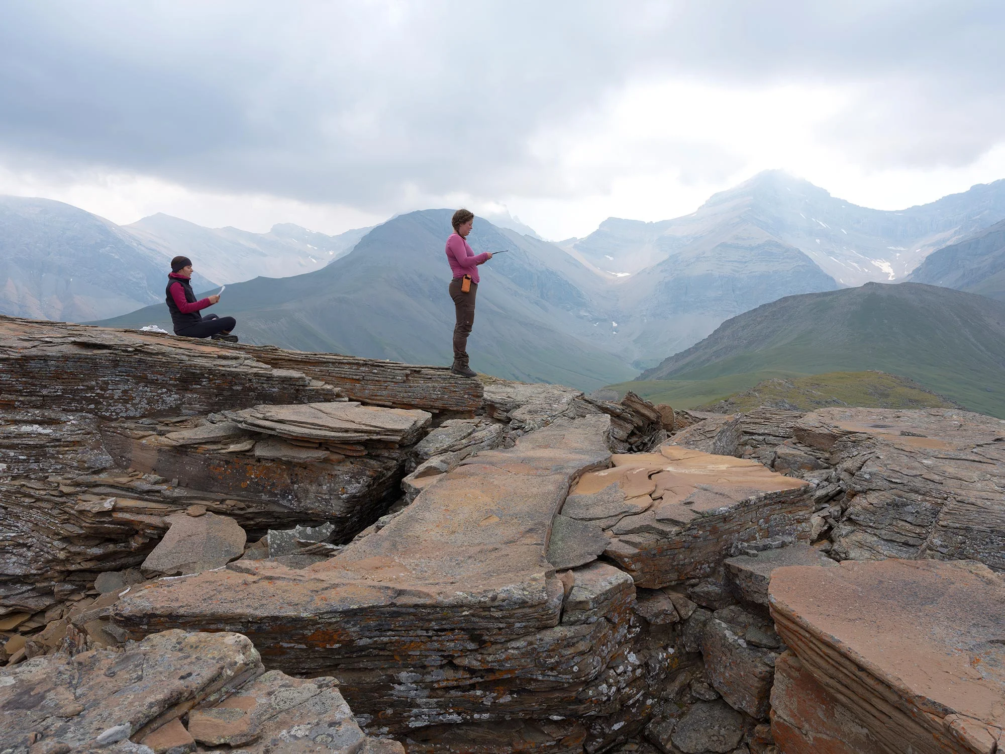
The Landscapes in Motion study area is vast (Fig. 1)—far too large to collect on-the-ground data across its full extent. The first challenge faced by the Fire Regime team was to select sites that were representative of the larger study area and together captured key gradients in the forest types, disturbance regimes, and physical setting (e.g. elevation, aspect).
To achieve this, they carefully analysed nearly 2,000 aerial photographs that they procured from the Canadian National Air Photo Library archives. These photographs, captured from 1949–52, represented the earliest available imagery with full coverage for the study region.
They chose six study areas that captured a broad range of the variation that exists in the Foothills and sampled broadly within each of them. These areas were grouped into northern (wetter) and southern (drier) sites. The northern sites contained more lodgepole pine and mixed stands of aspen, lodgepole pine and white spruce, while the southern sites included Douglas-fir forests as well as lodgepole pine.
Figure 1. Map of the Landscapes in Motion study area, with the Fire Regime team’s plots represented by dots. Inset: map showing plot boundaries for one of the sites; red dots indicate plots where tree cores were collected and “x” indicates where fire scars were collected. Image courtesy of Cameron Naficy.
Methods
In 2018 and 2019, the Fire Regime team and field crew hiked out across each of the six study sites, where they collected thousands of tree cores and hundreds of cross-sections of fire-scarred trees. These samples were later processed and crossdated using “master chronologies.” This means they were cross-referenced against other tree-ring records—ones with confirmed calendar dates linked to specific growth patterns—to ensure they were dated accurately. This labour-intensive process made it possible to learn each tree’s year of establishment, age, early growth rates, and for dead trees, the year of death. It also allowed them to assign an exact calendar year to each fire scar found in the cross-sections.
This landscape has been shaped by a mixed-severity fire regime with very frequent fire
One surprising result was that fires were quite frequent within the fire-sensitive forest types of the study area (Fig. 2), with median fire return intervals between 25–40 years for most cover types. Douglas-fir forests were the one cover type that had a notably frequent fires, with median return intervals ranging between 15–20 years between successive fires in a patch of forest.
Compared to lodgepole pine forests elsewhere, the team found more widespread fire-scar evidence within the Foothills. This included lodgepole pine trees with multiple scars, which was unexpected—lodgepole pine is easily killed by fire so surviving multiple fires, in some cases three or more, is impressive and indicates that many fires burned at low intensities.
The Fire Regime team used their on-the-ground data to reconstruct the fire history of the area. A timeline of these fires shows there were some very large regional fire years, including some years in which fires were recorded over more than half the study area, but that years with a small number of fires were much more common (Fig. 2). In fact, for the time period with the most data (c. 1800 onward), multiple small fires were evident in most decades somewhere within the Foothills.
The timeline also clearly illustrates the decline in regional fire frequency beginning in the 1930s that coincides with increased fire suppression effectiveness. Interestingly, the decline in local fire years predates that of regional fire years, coinciding with a major transitional period for First Nations groups following the signing of Treaty 7 in 1877, creation of tribal reserves in the 1880s, and enforcement of policies that prevented traditional burning by First Nations. This suggests that First Nations’ cultural fire use practices may have influenced the fire regime over a broad area by introducing a mosaic of smaller fires during a broader range of seasonal conditions.
This high historical fire frequency could have implications for how these forests are managed. Modern timber management practices are largely modeled after an ecosystem’s natural disturbance regime, and this approach has traditionally focused on stand-replacing disturbances with longer return intervals. If fires were more frequent and (as we will see in lodgepole pine) not always severe, this raises interesting questions about the ways in which these historical fire regimes could inform management approaches. It may also have implications for prescribed burning and fire suppression policies.
Figure 2. The study area was characterized by frequent fires, shown here as the percent of patches in which each fire year was documented. Regional fire years were defined as fires that were recorded in over 20% of patches in the study area, with fires that burned more than 50% of patches colored in red to highlight major and well-documented fire years. “Widespread fire years” were those recorded in more than 10–20% of patches. Overall, local fires (those recorded in less than 10% of patches) comprised 74% of all fire years.
Lodgepole pine and Douglas-fir zones show different mixed-severity fire regimes
Douglas-fir and lodgepole pine forests both had mixed-severity fire regimes, but these regimes—i.e., their fire frequency and severity—showed important differences.
Douglas-fir forests were characterised by very frequent, low- and moderate-severity fires, with occasional high-severity fires. Even during significant drought years like 1910, when high-severity fires would be expected, low- to moderate-severity fire effects were widespread and common. In other years, however, high-severity fire did burn in these forests. These highly variable patterns resulted in a complex mosaic pattern of stand ages and structures in the Douglas-fir zone that included old, intermediate, and young forest stands.
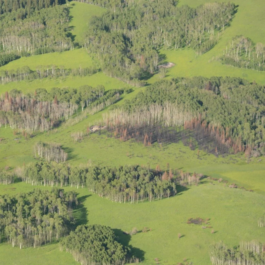
Lodgepole pine forests had a different mix: high-severity fires were most common but there were more low- and moderate-severity firesthan expected. Some fire years were entirely high severity, while others experienced a component of low- to moderate-severity affects. Few lodgepole pine trees survived more than two fires, although exceptional trees survived three or four, hinting at a landscape that was in a state of flux. Despite the prevalence of high-severity fire effects in these forests, they burned in a heterogeneous pattern that created a mix of stand ages. These diverse stand ages were evident in our age structure data and in early survey images taken in the area (Fig. 3).
Figure 3. Examples of the complex pattern left by a recent fire in the lodgepole pine/aspen forest photographed here in 1940 by R. J. Parlee. Imagery courtesy of Mountain Legacy Project.
The historical mixed-severity fire regimes of these two forest types are both more complex and included more frequent fire than previously assumed. While lodgepole pine forests do experience many high-severity fires, the heterogeneity of fire severities and burn patterns led to a greater degree of structural complexity than expected (Fig. 4A). Likewise, the mix of fire severities in Douglas-fir forests produced stands that are extremely variable and many that are complex, open, patchy, and often interspersed with grassy meadows or aspen (Fig. 4B).
Figure 4. Examples of forests that result from mixed-severity fire regimes. A) A complex lodgepole pine stand with trees of multiple sizes and ages. B) An older, more complex Douglas-fir forest with a sparsely-vegetated understory. Photos by Cameron Naficy.
The lodgepole pine zone is a frequent fire, fire-sensitive ecosystem
The fire regime of lodgepole pine forests has long been characterized as relatively infrequent (e.g., every 80–400 years) and severe. These long intervals are thought to be critical for allowing sufficient time for forest regeneration and recovery in between severe events. The fact that fires occurred more often in our study area suggests that lodgepole pine forests were more resilient to frequent fire than previously believed. The patterns that the LIM Fire Regime team documented hint at some of the potential mechanisms that may help to explain this: where fires were more frequent, the fire regime became more diverse with a mix of low-, moderate- and high-severity fires, and even high-severity burns began to produce more heterogeneous patterns.
The result of this fire regime was that most of the forest in the montane zone, an area covering tens of thousands of hectares, consisted of young (median age of only 22 years), short-stature multi-aged and even-aged stands recovering from recent fires! This finding contrasts with the typical assumption that young pine forests will be simple and even-aged over broad areas. Portions of the lodgepole pine forests with the most frequent fire often contained a complex patchwork of grassland, extensive aspen and patches of spruce/fir that included uneven-aged groups of trees and even-aged patches of different ages (Fig. 5A). Other parts of the landscape, especially those with more intermediate fire intervals, experienced larger fire events that created a coarser patchwork of grasslands, burned and unburned forest, and multi-structured patches where some trees survived (Fig. 5B).
Figure 5. Lodgepole pine forests had greater structural complexity than expected. A) This site in the Elbow River area, photographed in 1940 by R. J. Parlee, had a mix of aspen- and conifer-dominated patches with a mix of both multi-aged and even-aged patches. B) The Old Man River West study area, near the Livingston Gap, photographed three years after the large 1910 fire by M. P. Bridgland, contained large burned patches, unburned patches, some partially burned patches with scattered surviving trees, and perennial grasslands. Historic images courtesy of Mountain Legacy Project.
The Douglas-fir zone burned often, and with more severe fires than expected
Forests in the Douglas-fir zone experienced very frequent low- and moderate-severity fires. High-severity fires were less common (with a median return interval of 71 years), but they were an important part of the dynamics of these forests and more common than typically expected.
The combined effects of the moderate- and high-severity fires led to variable and complex stands. A wide range of forest patches were observed, including:
clusters of very old trees that survived multiple fires (Fig. 6A),
individual old trees with multiple fire scars surrounded by younger trees (Fig. 6B),
medium-aged trees with multiple fire scars (Fig. 6C),
young, open-canopy woodlands (Fig. 6D), and
mixedwood forests with old Douglas-fir snags or deadfall (Fig. 6E).
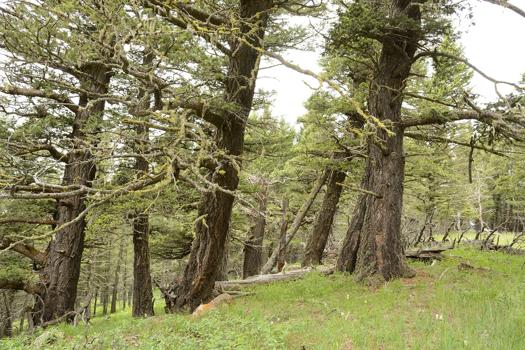
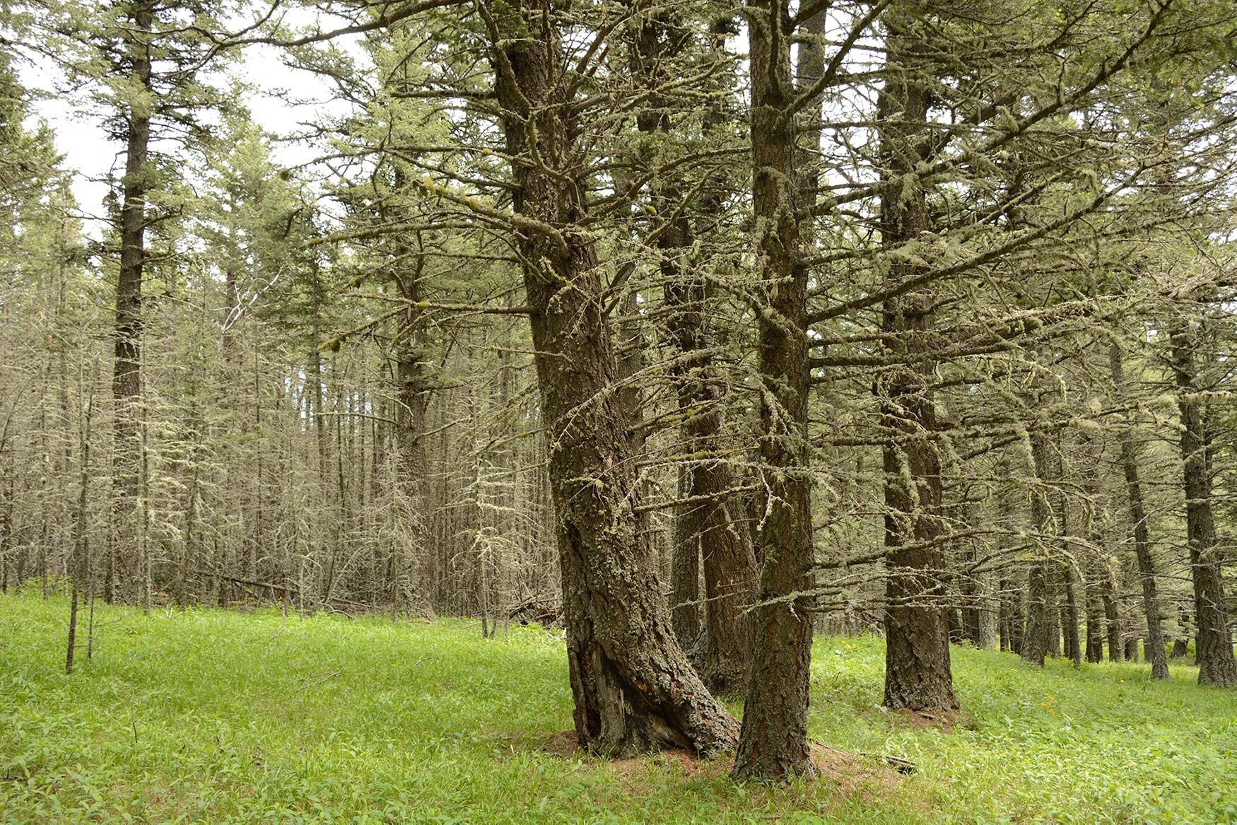
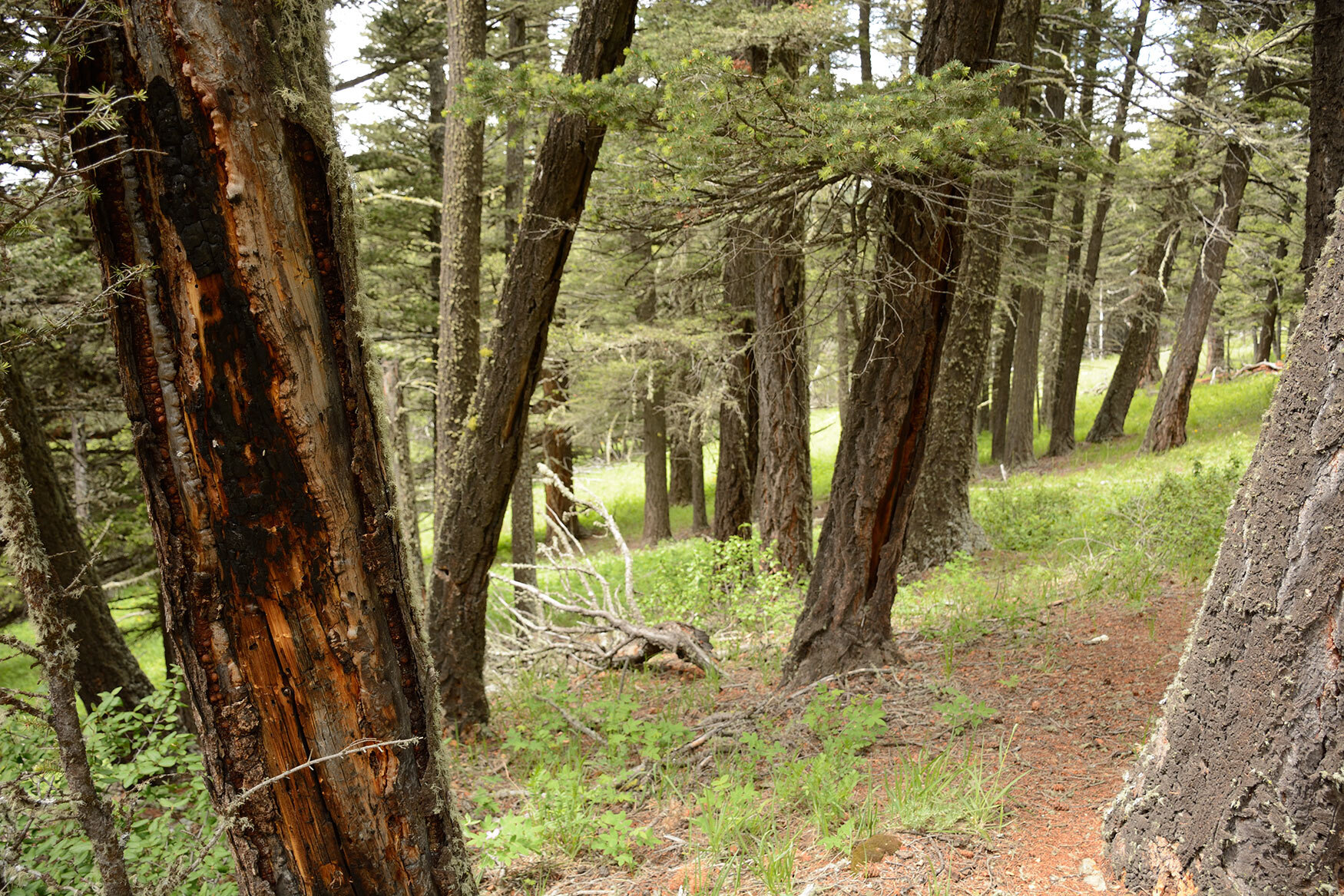
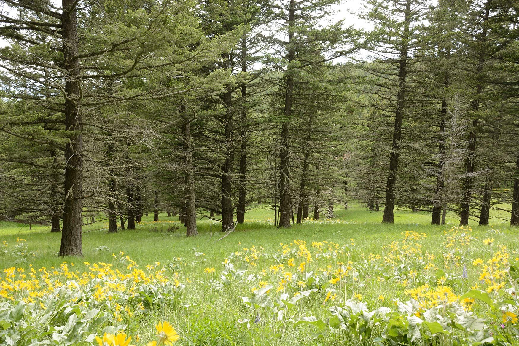
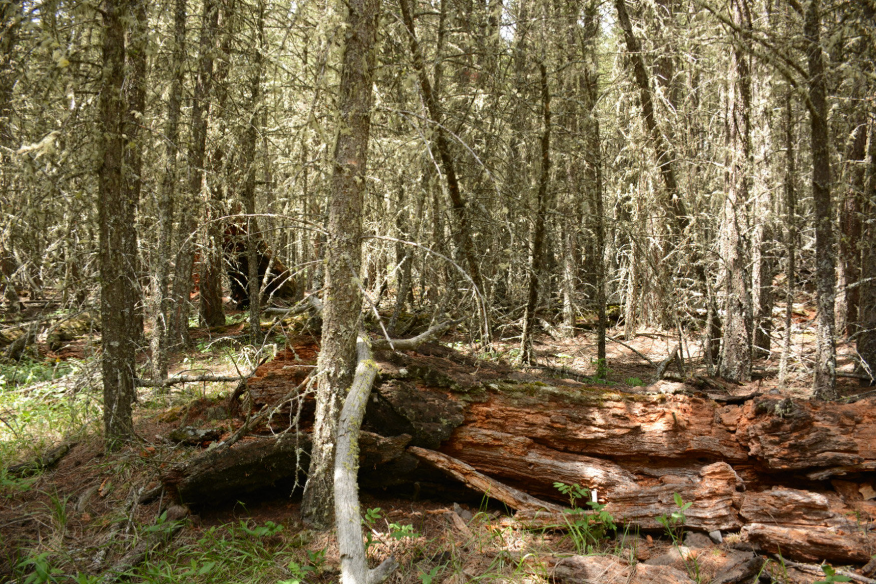
Figure 6. Examples of forest patches in the Douglas-fir zone resulting from a mixed-severity fire regime. Photos by Cameron Naficy.
This fire regime also resulted in two types of forest conversion: in some cases, areas capable of supporting forests were maintained as perennial grasslands by frequent burns, and in others, old multi-aged Douglas-fir stands were converted by high severity fire to dense, regenerating Douglas-fir or mixedwood forests (Fig. 6E).
At the landscape scale, Douglas-fir patches were intermixed with lodgepole pine, aspen and spruce forests, which are less fire-resistant and experienced much more severe fires. Sites with more of this intermixing, like the northern Porcupine Hills, typically had higher and more variable fire severity than other sites.
This variability creates an important contrast with the low-severity fire regime generally assumed for Douglas-fir forests, which would be expected to create consistently uneven-aged, open stands with an old age component.
Accounting for Indigenous burning when interpreting fire scars
When analysing tree cores and fire scar cross-sections, researchers sometimes encounter inter-ring scars—scars that are located between two tree rings. Interpretation of modern fire records would suggest that these fires originated in the late summer or fall, when forests are more drought-stressed and lighting strikes or fires accidentally set by humans can spread easily. This pattern is common in many forests in the southern Canadian Rockies, both today and historically.
However, in this region Indigenous fire practices were widespread and included regular fall, winter, and spring burning that appears to have contributed substantially to the fire regime. Given this context, many of the inter-ring scars collected by the Fire Regime team may have been left by human-set fires that burned during the dormant season of trees, between the late summer of one year to the spring of the next. Teasing apart these alternative scenarios required painstaking analysis. When coupled with observational records that show the Foothills to be part of a notable lightning shadow (i.e., an area with low frequency of lightning strikes capable of igniting fires), it suggests that cultural fire use practices likely played an important role in shaping the forests of southwestern Alberta; it also revealed lodgepole pine’s unexpected resilience to frequent fires.
The research done by the Fire Regime team is an important step to better understanding the relationships between fire regimes and the structure of forests and landscapes, and has yielded clues about cultural burning practices that played a role in shaping these landscapes. However, an important opportunity exists to take this research even further by collaborating with Indigenous peoples to tell the story of the landscape. An example of this work is the work of new graduate student Maya Frederickson with the Mountain Legacy Project and University of Victoria, who is studying what “spatial signatures” might correlate with historic Indigenous land stewardship and is working alongside the Stoney Nakoda First Nation.
Efforts across teams
The Mountain Legacy Project’s vast library of historical photographs provides an exciting opportunity to fill the gaps in the tree-ring record, and collaboration between the Fire Regime and Visual Applications teams is already underway. Seventeen historical photos that look over the landscapes where on-the-ground Fire Regime plots are located have been analysed by the Visual Applications team using the expanded Image Analysis Toolkit. In many cases, there are two or three historical photos in different surveys that were taken before and after a fire. These photographs will make it possible to understand how these forests looked before they burned—something not possible from dendroecological data alone because some of the evidence is burned away—and shortly after they burned. This is a rare opportunity to study vegetation transitions (e.g., from grassland to conifer forest) and their drivers.
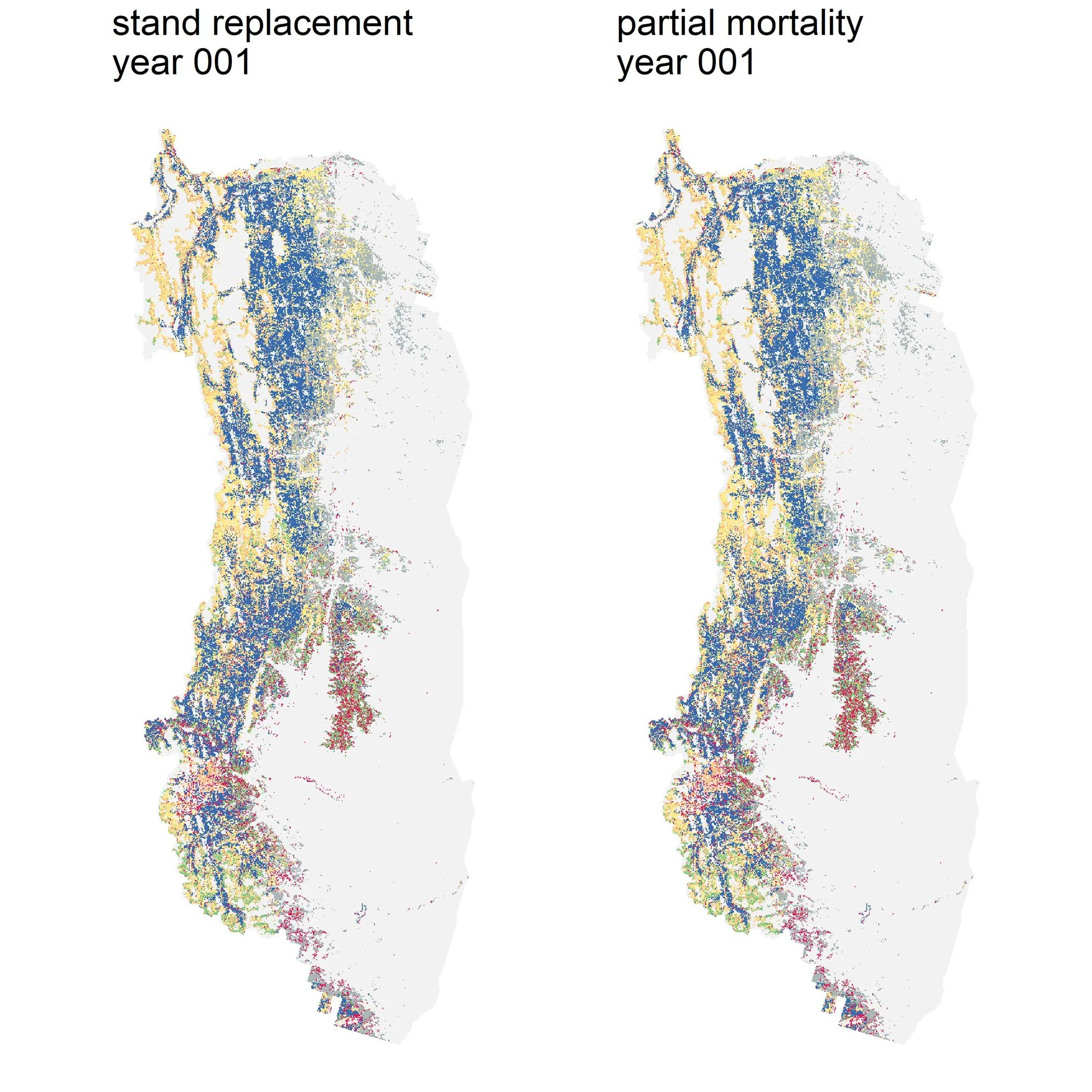
The Modeling team’s work also provides a unique opportunity for collaborative research, which is currently underway. The Fire Regime’s dataset will make it possible to quantify the feedbacks between fire severity and frequency to other influences on fire like climate and topography. For example, climate drives weather conditions like drought and lightning storms, which in turn affect fire frequency and severity, which in turn affect which vegetation survives and what grows back, which in turn affects fire severity… Feedbacks are interconnected and complex, and are difficult to untangle, but they are critical to understanding ecological systems. Having this dataset makes it possible to model these feedbacks, which can then be used as a calibration tool to further refine the Modeling team’s partial mortality simulation model.
What comes next?
The work done by the Fire Regime team opens the door to many new and exciting research opportunities that are being explored as next steps, including:
Understanding ecosystem responses to changes in fire frequency and identifying critical fire frequency thresholds to help predict future outcomes of different climate and management scenarios.
Mapping historical vegetation conditions and understanding how they changed along gradients of fire frequency, topography and soil moisture.
Expanding our collaboration with Indigenous experts to combine our knowledge and enrich interpretations of the historical fire regime.
Conducting a synthesis of fire history data from this and other studies and developing a spatially explicit (i.e., locations on a map) regional fire frequency model for Alberta’s Foothills.
Sonya Odsen is an Ecologist and Science Communicator with a background in boreal ecology and conservation. She is a regular writer for Landscapes in Motion and is part of the Outreach and Engagement Team for the project.
Cameron Naficy is a member of the Fire Regime Team of Landscapes in Motion. He was previously a Post-Doctoral Scientist in the Tree-Ring Lab at the University of British Columbia and is now a Research Ecologist with the Department of Forest Ecosystems and Society at Oregon State University.
Every member of our team sees the world a little bit differently, which is one of the strengths of this project. Each blog posted to the Landscapes in Motion website represents the personal experiences, perspectives, and opinions of the author(s) and not of the team, project, or Healthy Landscapes Program.