
Burning Questions: The LIM Team’s responses to questions from the online workshop
/The Landscapes in Motion Online Workshop (Oct. 22, 2020) was a great experience for our research team. It was an afternoon marked by great questions and exciting discussion. So much so, we ran out of time to answer the questions pouring into the Zoom chat, and we received several more in our post-workshop survey!
Members of the Landscapes in Motion team have responded to the outstanding questions below. Questions and answers have been lightly edited for clarity.
Note: The responses below represent the views of each member of the Landscapes in Motion team. Any opinions, suggestions or recommendations are their own, and are informed by their stores of knowledge and their individual research. They do not represent the positions of their respective institutions, including but not limited to the University of British Columbia, the University of Victoria, fRI Research and the Government of Alberta.
A fire where high severity occurs is also likely to contain portions of moderate to low severity. Did you see that in your data? If so, how much did topography influence these differences?
Cameron Naficy, Fire Regime Team: The answer here is different for different forest types. In the lodgepole pine zone, high severity fire was dominant in most of the fires. Some were predominantly high severity, while some had low-to-moderate severity effects mixed in. In the Douglas-fir zone, most fires were mixed—although the mix could be skewed more towards higher or lower severity for different years. We haven’t yet explicitly modeled the influence of topography on the fire severity or fire regime patterns we found. My sense is that severity is likely to increase at higher elevations, and I expect less variation to result from micro-scale topographical factors like aspect or landform.
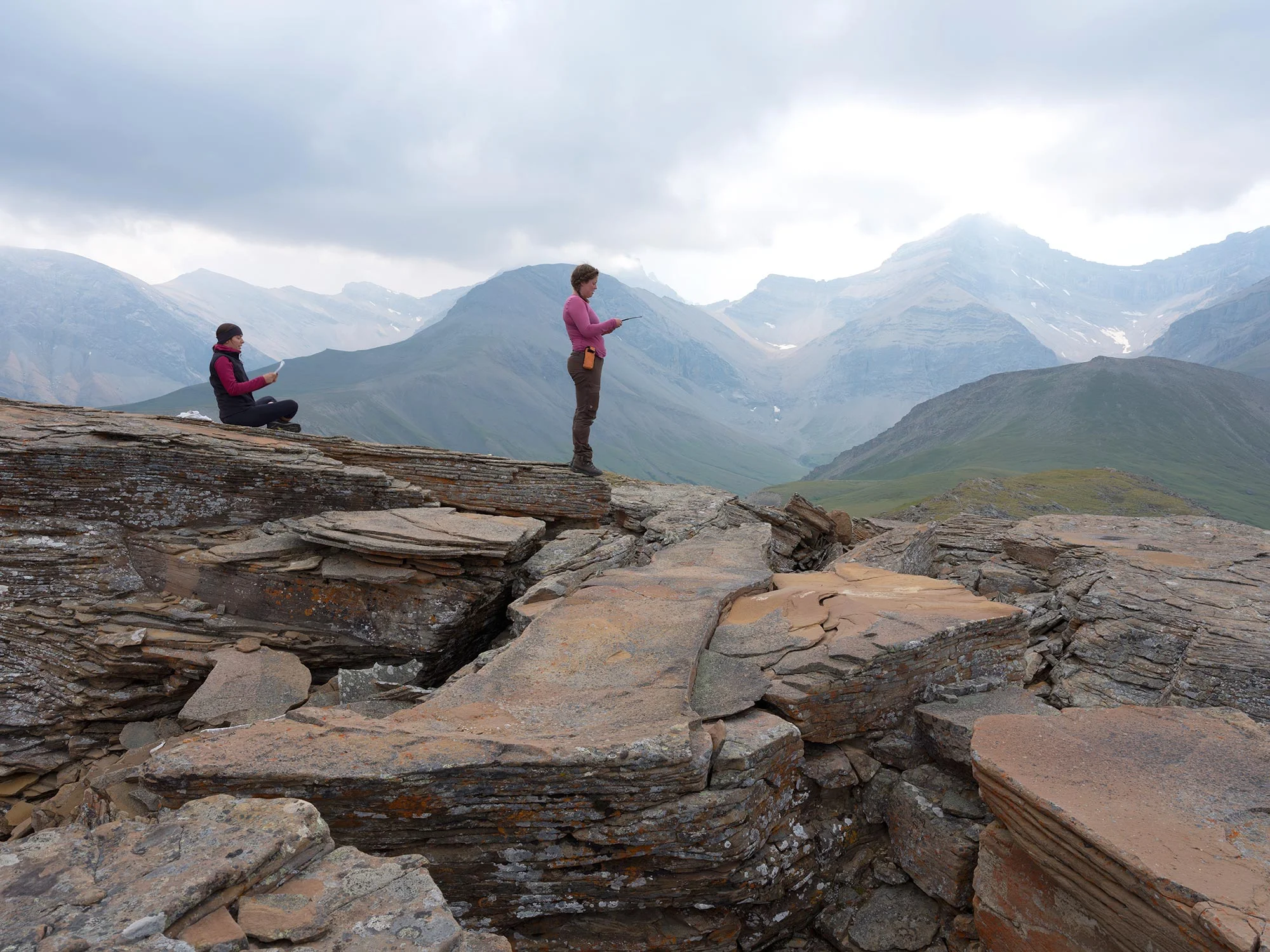
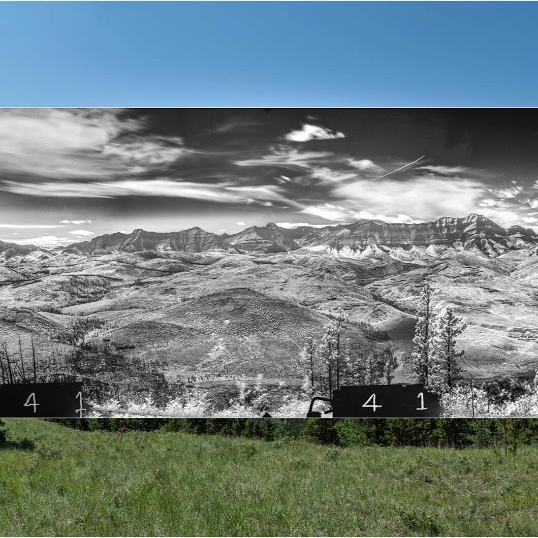
Eric Higgs and Mary Sanseverino, Visual Applications Team: There is widespread evidence of fires of variable severity showing up in MLP images, and these data can be teased out either photo by photo for specific applications, or across the landscape using recently developed tools. We think this set of images from the Lost Creek fire might be interesting to contemplate—the image looks west from Willoughby Peak, right into the Lost Creek fire area. Note the micro-scale differences visible in these images. The modern panorama was taken in 2015.
Looking west from Willoughby Peak, Crowsnest Pass area, southern Rocky Mountains. Further modern (2006) and historic (1913) views from this area are available at explore.mountainlegacy.ca/stations/1154. Photo courtesy of the Mountain Legacy Project (mountainlegacy.ca) and Library and Archives Canada/Bibliothèque et Archives Canada.
Are forests still being managed primarily from a resource perspective (lumber), or is there a shift to more of an ecosystem-based approach to management? Forests are more than just their trees, no?
Dave Andison, Project Coordinator: The primary objective of most management activities (e.g., timber value) has not fundamentally changed. However, forest management in Canada has been including an increasingly wider range of other ecological, social, and economic objectives for many decades now. This was formalized more than 20 years ago under the auspices of sustainable forest management (SFM) and has helped make Canada a leader in sustainability. Ecosystem-based management (EBM) takes a step beyond managing for multiple values to promoting ecosystem health and integrity as the primary objective.
Is vegetation mortality still the best measure of fire severity? Mortality seems to be using a loss-of-resource frame. Are there other ecosystem-based approaches being considered (structure, function, biodiversity) instead for framing fire impacts or influences on the landscape? Or is vegetation mortality the most relevant/easiest to measure?
Dave Andison, Project Coordinator: There are several other measures of fire severity including depth of burn, the nature of fire scarring on tree boles, mineral soil exposure, and biomass loss. Vegetation mortality is convenient, easy to measure and understand, translates easily to forest management activities, and correlates well to other severity measures.
Cameron Naficy, Fire Regime Team: I think vegetation mortality is a good representation of one aspect of fire severity. I think it is important to distinguish the colloquial understanding of severity from its ecological meaning. By this, I mean that severe often has a negative connotation. This is not de facto the case with the ecological definition of severity. High severity fire can have positive ecological outcomes.
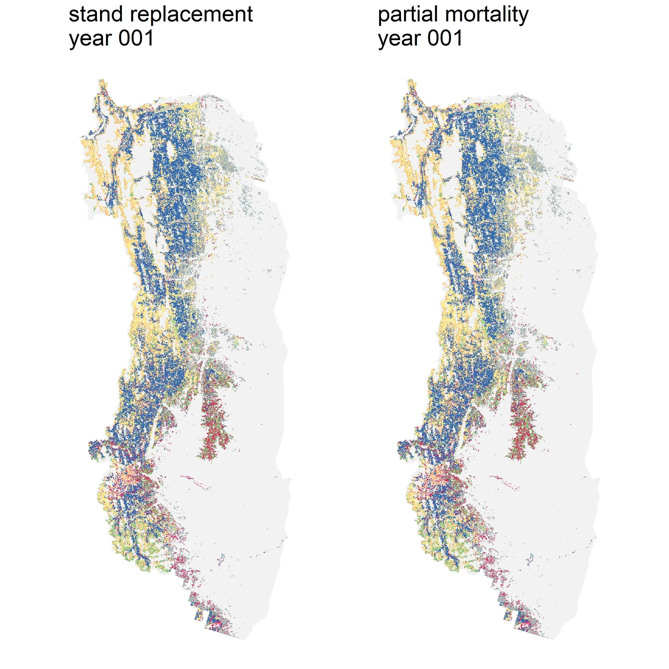
Eliot McIntire, Modeling Team: For the Landscapes in Motion project, we did not attempt to connect fire severity to any other measures, such as soil organic matter burn depth. These can matter, for example to estimate soil carbon changes. Similarly, we did not evaluate other consequences of fire severity, such as biodiversity effects. Tree mortality can act as a decent index of severity that can then be used by the land managers to evaluate these and other indicators that are of interest.


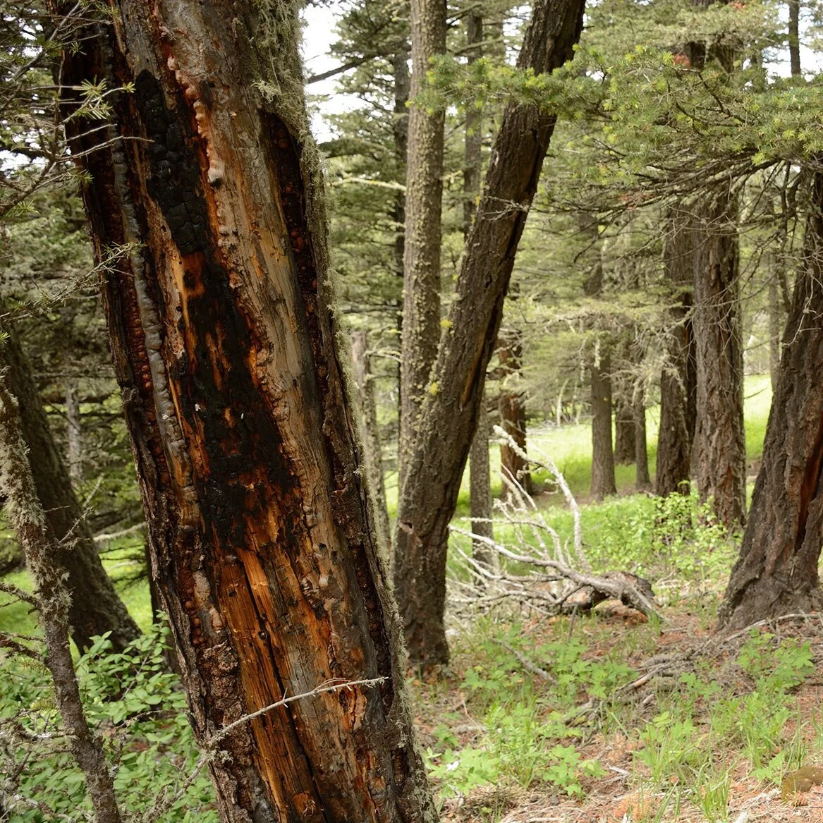
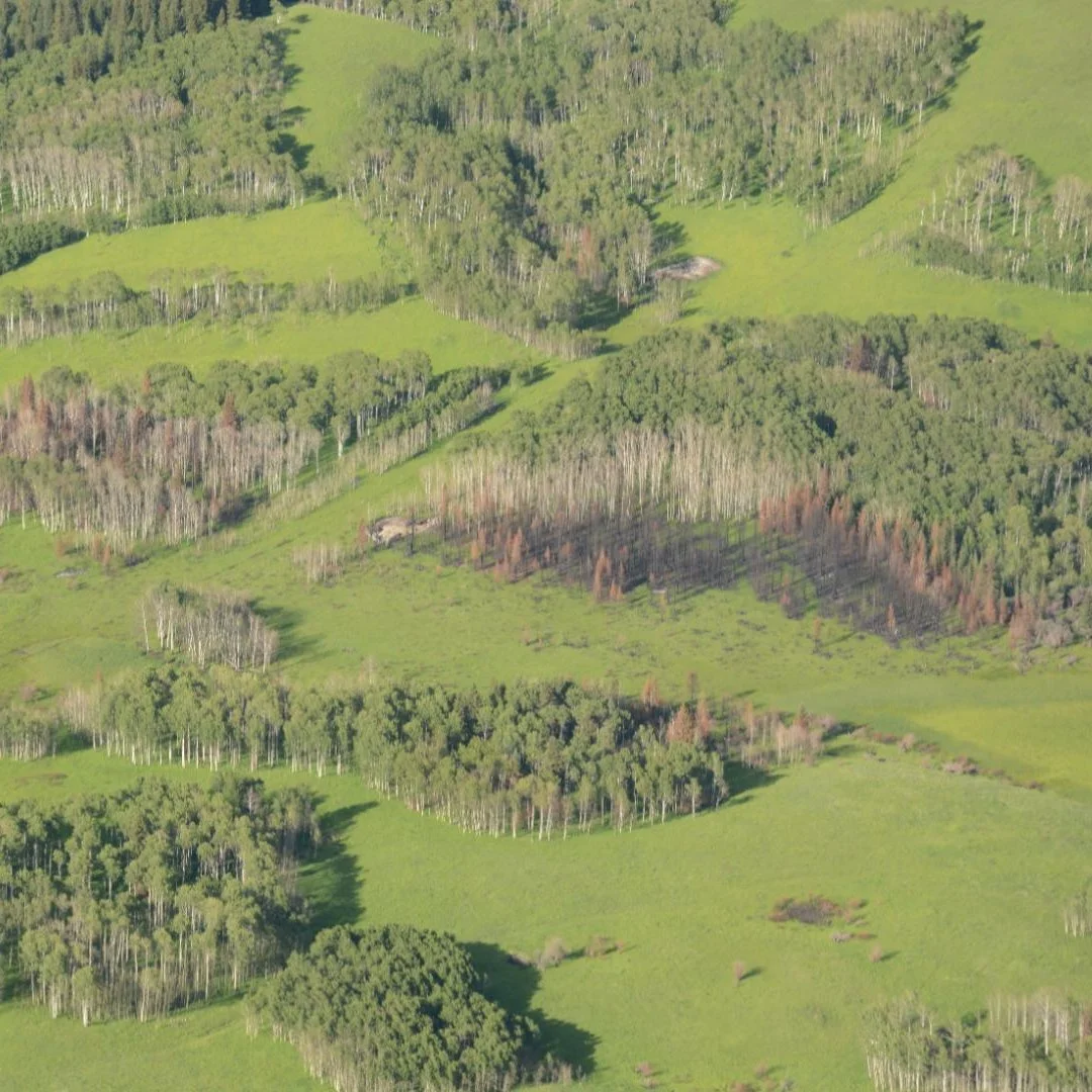
Tree/vegetation mortality is a common index of fire severity—i.e., a fire is considered more “severe” if it kills more vegetation. This is how we quantified fire severity with Landscapes in Motion, but as Cameron notes, a fire being more “severe” and killing many trees may have positive ecological results. Photos by Cameron Naficy.
What were you able to accomplish or better understand by using a range of techniques (fire history, modelling, oblique imagery) that you would not have known individually (i.e., how is the whole bigger than its parts)? What techniques/perspectives are missing that could be valuable to this or future projects?
On Integration:
Dave Andison, Project Coordinator: This integration of the three approaches was a part of the innovation (and thus experimentation) of this project. I do agree there were definite tangible benefits. But most of the integration occurred in the last few months—after the work of each team had matured sufficiently to even allow cross-over. The lesson learned for me is that the real power of a truly integrated project like this one is that it requires more time at the end than we are normally accustomed to fully realize. This could potentially be a one- to two-year Phase II proposal.
Mary Sanseverino, Visual Applications Team: Working with the Fire Regime and Modeling Teams gave us a different perspective on the historic and modern images. For example, looking at the images to see if we could determine tree density and height, and then visualize this in the images in a number of different ways, was both eye-opening and challenging. Working with the larger Landscapes in Motion team allowed us to fine tune and build capacity in our software in ways that we might not have done without the collaboration. For example, building the software to orthorectify land cover classes directly from historic photos was not something we had explored before. We had always focused on the historic/modern pairs.
Eliot McIntire, Modeling Team: The Modeling Team needs high quality data to evaluate, test, and validate our models. These sources of data would normally be limited to “currently available” data, such as Forest Inventories or Remote Sensing. All of these existing datasets are of limited value in the study area because there have been few fires this century. During the Landscapes in Motion project, we attempted to use the older conditions coming from the Fire Regime and Visual Applications Teams to help parameterize and build our models.
On Techniques/Perspectives:
Sonya Odsen, Communication and Education Team: As the blog editor and one of its writers, I’ve observed that Indigenous burning is an important theme whenever we talk about these forests and their fire ecology. Each of our teams has observed patterns and trends that hint at the role and importance of historical Indigenous burning, and Amy Cardinal Christianson’s amazing guest post to our blog provides a critical perspective on not only its historical role but also contemporary burning and efforts to revive this practice. I’m excited about future work that graduate student Maya Fredrickson will be doing with the Mountain Legacy Project, working alongside the Stoney Nakoda First Nation to understand what “spatial signatures” might correlate with historic Indigenous land stewardship in the LIM study area. I think that work to include Indigenous voices, histories and perspectives more directly and collaboratively will be of great value for any future work.
When I began my Forestry career, it was conventional wisdom that the eastern slopes burned on a macro-scale around 80–100 years [editor’s note: this refers to the average fire return interval, or how often a forest burns on average]. Your research shows that fire frequency may actually be more in line with 20–40 years, for lodgepole pine for instance. Is that 20–40 years an overall historical average? I'm curious of frequency of fire in pine, pre-suppression era vs post-suppression era, and the impacts that fuel loading in pine may have on future wildfire incidents.
Cameron Naficy, Fire Regime Team: Most previous studies were in higher elevation forests than our sample, so our finding of shorter intervals doesn’t conflict with this data. Rather it describes the average return intervals across a very large north-south oriented swath of the montane and lower subalpine forest within this region. There was some variation within this broad zone, with shorter average intervals around 20–30 years in the lower montane and longer average intervals around 30–45 in the upper montane and lower subalpine. But overall, there was a surprisingly narrow range (i.e., low variability) of fire intervals across our broad study area. Post fire suppression (e.g., post 1940s) there has been very little fire at all, with the exception of a few individual fire years (i.e., 2003, 2017), so we can’t robustly quantify return intervals in the post-suppression era.
We are developing models of feedbacks between fire frequency and severity that will help to indirectly address the question of fuel loading influence on fire outcomes. Given lodgepole pine’s vulnerability to fire, I expect that the direct influence of fuels on fire severity is more limited than in a forest with fire resistant species such as Douglas-fir, ponderosa pine, or western larch. I think frequent fire may have operated more strongly by reducing the abundance of dead woody fuels, spatial heterogeneity of vegetation, and increasing aspen abundance, all of which influence the sizes, shapes, etc. of fires.
Dave Andison, Project Coordinator: On behalf of the true boreal bits of the forest, the perception is changing—and in a similar direction. Recall from the introduction presentation that natural boreal wildfires across western Canada average about 40% survival. This is inconsistent with the idea of a “stand-replacing” fire regime. Indirectly, this information impacts our assumptions about fire frequency. For example, in the few places in the western boreal forest where we have managed to collect detailed fire scar and tree-ring data, return intervals have been consistently lower than previously presumed.

(Left to right): Alex Chubaty (fRI Research), Cameron Naficy and Ceres Barros present tree cross-sections with several burn scars. These trees burned several times in their lifetimes, reflecting short fire return intervals. Photo by Sonya Odsen.
How would/could the Government of Alberta use the results of this research in C5 forest management planning to determine the most appropriate rate of harvesting (annual allowable cut), stand retention requirements and patterns (fragmentation) considerations? [Editor’s note: the C5 Forest Management Unit is located north of Waterton Lakes National Park and south of Kananaskis Country, encompassing just over 3,500 km² of public land.]
John Stadt, Science-Policy Advisor: Forest management plans are created every 10 years and reflect a balancing of social, environmental and economic values. Science informs the decision making in balancing these values. Risks to achieving these values, such as fire risk, or risk of mountain pine beetle may change through time and this will affect how plan targets are set. The results of this study indicate that some of the questions being asked about the complexity of disturbance regimes are worth paying more attention to both in the southwest of Alberta and in other regions. The model developed in this study is a first step to being able to use this understanding in planning.
What, if any, role do (healthy) riparian areas play in the movement, severity, and impacts of wildfires on a landscape? Do they tend to burn with the rest of the forest, or are they better able to withstand/survive wildfires, and thereby contribute to post-fire heterogeneity and succession/recovery? [Editor’s note: “riparian area” refers to the zone between a water body (stream, river, lake, pond, etc.) and the upland—commonly known as the shoreline.]
Dave Andison, Project Coordinator: It depends. In areas with topography (e.g, the foothills), informal evidence from other Healthy Landscapes Program (HLP) research suggests that riparian zones are just as likely to burn as other parts of the landscape. On flatter terrain out in the boreal plains, riparian zones are in fact less likely to burn. The difference has more to do with soil moisture conditions and the resulting vegetation type. On a related note, we have also learned from other HLP research quite a bit about the critical link between wildfire in riparian zones, tree mortality, and the amount, type, and role of the large woody debris created. (The HLP reports I reference above are available upon request.)
Have proximity to surface water, and health of riparian areas, been incorporated into models or have these models focused on large tracts of forests, uninterrupted by streams and rivers?
Eliot McIntire, Modeling Team: The models presented as part of Landscapes in Motion used fuel (derived from tree species, age and biomass), fire weather and land cover. Land cover (e.g., wetland, moist conifer, dry conifer, etc.) does attempt to account for this type landscape variation, though not at the level of “health of riparian areas.”
Dave Andison, Project Coordinator: Just to add to Eliot’s answer, and as it relates to the preceding question, having the model respond to wetlands as opposed to riparian area proximity is likely to be more representative of actual fire behaviour.
Do you think the regular intervals of fires in a natural forest might be similar to the use of commercial thinning entries every 10–20 years with a final harvest in 80–100 years?
Dave Andison, Project Coordinator: I think you are on the right track, but the details are important. What we did not talk about too much in the workshop is that natural fire intervals were historically highly irregular. A single location might have burned in 1880, 1890, 1905, and then not again until 1960. It is not unusual to see some historical fires overlap by 5–10 years. Consistent with the EBM concept, this is Mother Nature’s way of creating a whole new layer of complexity and diversity to keep landscape ecosystems resilient. So, to translate this idea into management activities without the benefit of specific understanding of disturbance timing and severity, a reasonable rule of thumb would be to use both thinning and final harvesting—and even prescribed burning—across a range of time and space scales.
I and some others have a specific interest in the water conservation aspects that might comprise a separate workshop. This ties into the broader question about applications too. For example, certain harvest techniques could maximize water conservation but would have negative impacts on many other values—economic, recreational, aesthetic, and possibly biodiversity. How can we reconcile and optimize these aspects?
Mary Sanseverino, Visual Applications Team: Good question! Land managers, planners, communities, etc. need an ever-expanding toolbox to help understand how strategies might impact not just the land base, but whole ecosystems. Participating in Landscapes in Motion helped the Visual Application team from the Mountain Legacy Project build software tools that assisted in the project, but these tools can be applied in many different scenarios. Consider, for example, the following images from Elbow Falls: historic (1897), pre-2013 flood (2008), immediately post-flood (2014), and five years on (2018). These images show interesting changes in the riparian area. Indeed, they may pose more questions than they answer.
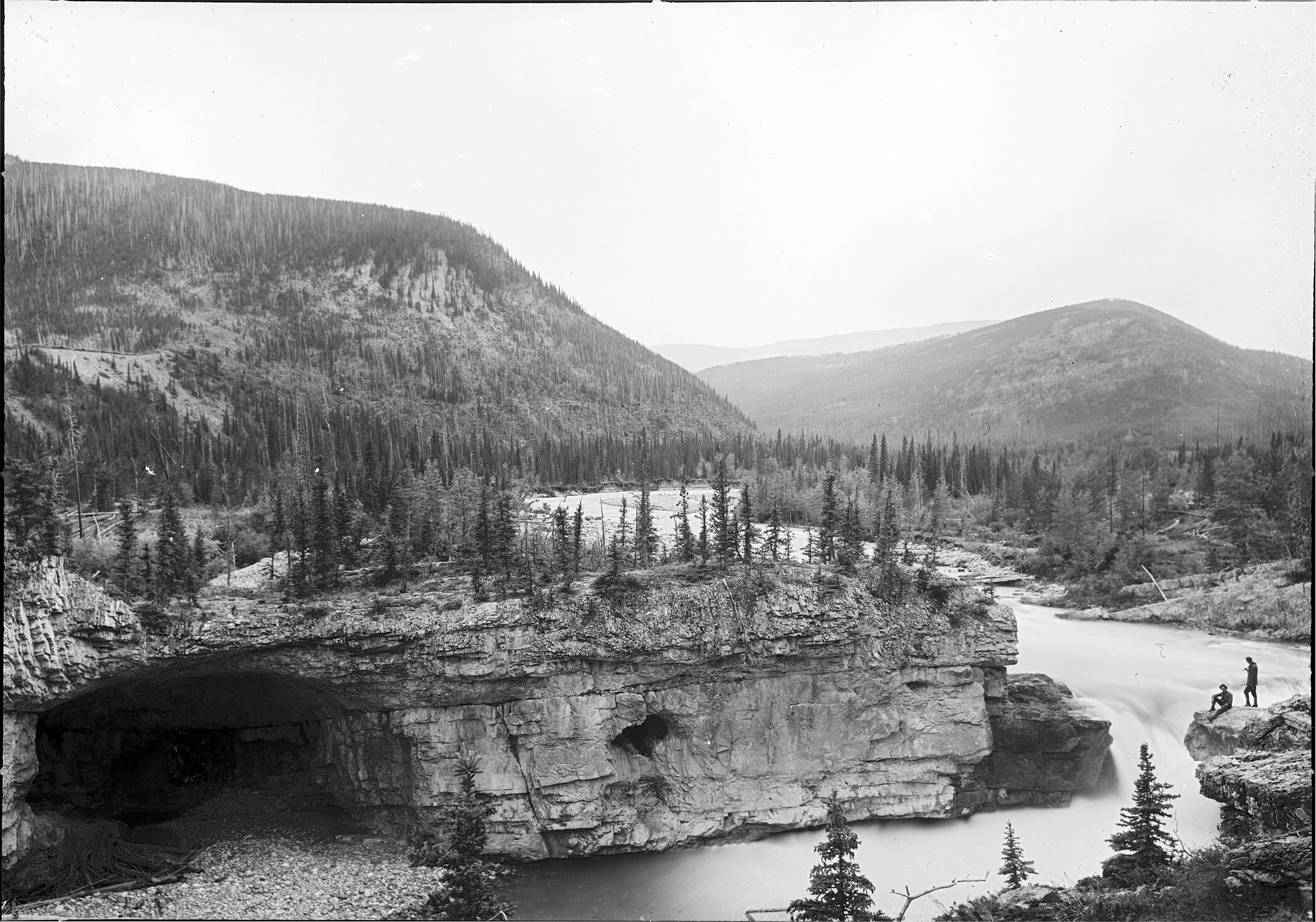
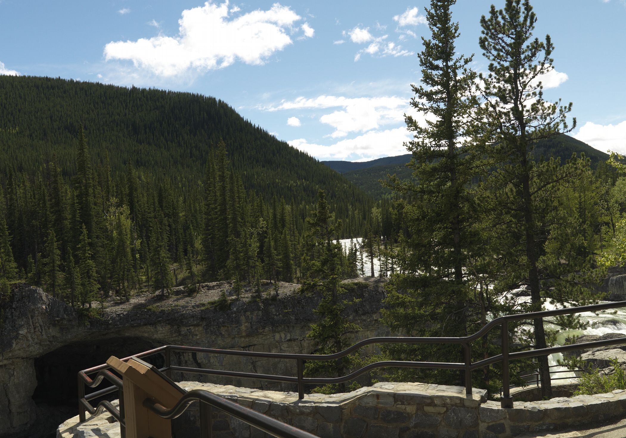
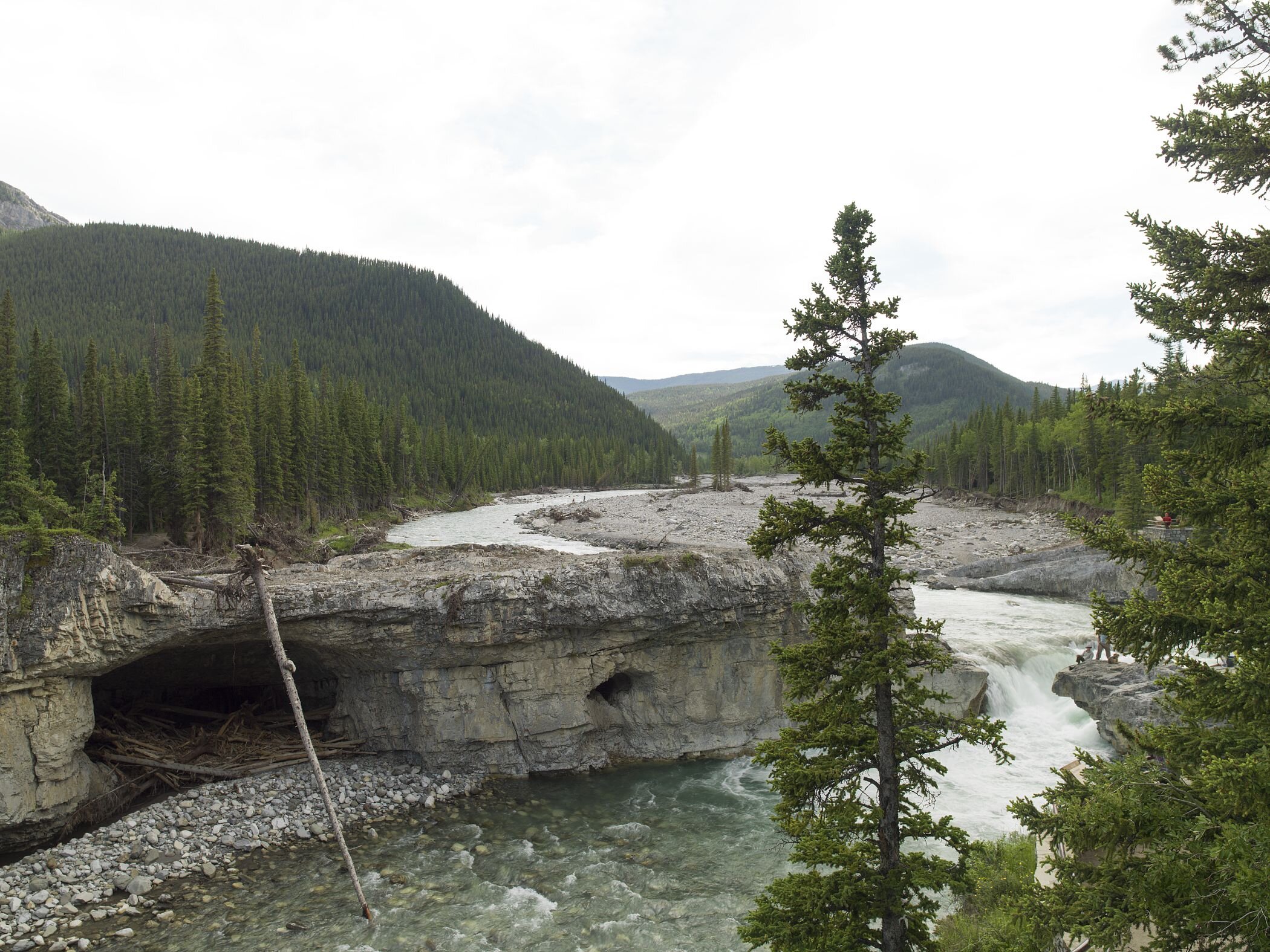
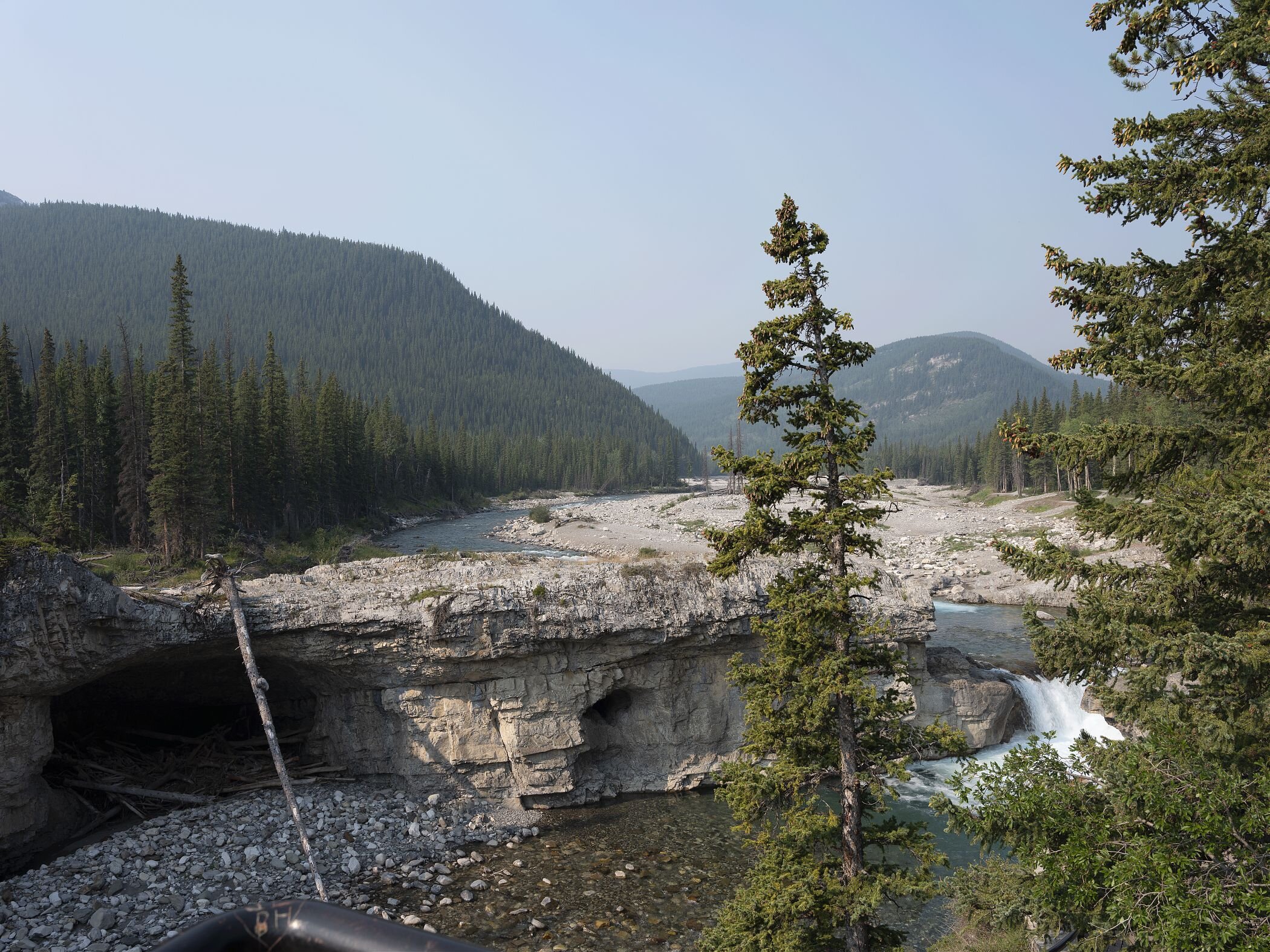
Image series taken at Elbow falls showing the historic condition (1897) and modern photos that precede and follow the major flooding that occurred in 2013 (pre-flood (2008), immediately post-flood (2014), and five years on (2018)). See the full set of images in their geographic context at http://explore.mountainlegacy.ca/stations/634. Photos courtesy of the Mountain Legacy Project - mountainlegacy.ca/ and Library and Archives Canada/Bibliothèque et Archives Canada.
Dave Andison, Project Coordinator: The main challenge of the idea of using historical reference points to help guide forest management is it assumes that the conditions under which disturbance occurs are similar. We know this is not entirely true (e.g., fire is a chemical process, harvesting is a mechanical process). We also know that “harvesting” takes many forms—there are a range of harvesting and silvicultural techniques available. So it may not be a question of “IF” harvesting, but rather “HOW” harvesting. This question an ideal candidate for a comprehensive and integrated pilot study. And sooner than later given its relevance.
I would like to better understand why the short fire return cycle although there is likely no definitive answer. Did the impact of Indigenous burning, even though possibly not extensive overall, influence fire patterns of natural events (lightning) so that natural events were not as extensive or as severe? If so, what would a pre-industrial forest look like without Indigenous burning? Have we underestimated the influence of Indigenous burning on the overall landscape? What other explanations are there?
Cameron Naficy, Fire Regime Team: This is a very difficult question to answer definitively. Identifying the degree of influence of Indigenous fire use practices is hard to do quantitatively. Our data suggests that Indigenous fire use may have played a fairly broad role in shaping the fire regime, at least of the montane zone. This may have been accomplished by burning during a variety of seasons outside of the peak fire-prone summer drought window, which helped to control fire sizes. These smaller fires may have played a role, subsequently, in the impacts of large summer wildfires, although this is still somewhat speculative.
Eric Higgs, Visual Applications Team: The Visual Applications team is supporting research that identifies potential areas of Indigenous land management in historical imagery from the pre- or early-colonial period. This work is early and so far our hypotheses quite general. However, as Cameron notes above, evidence from other jurisdictions suggests a reasonable likelihood of Indigenous management/burning altering “natural” fire patterns.
Eliot McIntire, Modeling Team: We certainly can test some of these points in our models, though I believe there would have to be some assumptions (or data may exist that I am not aware of). For example, was Indigenous burning practiced under extreme fire weather conditions or cooler conditions? But, if we can make some assumptions about this, then we can evaluate a scenario with frequent, low severity fires and less frequent fires that are likely more severe as they would happen during extreme fire weather. Comparing the tree composition, and the resulting “lightning” fires that would occur in each scenario, we could answer questions like “would lightning fires have been less severe because of Indigenous burning?”, and “would we have as much Douglas-fir on the landscape with no Indigenous burning?”
Now that we have a good sense of pre-industrial fire regime and an idea that the future will be significantly different, we have a better chance of implementing better forest management techniques. The question is, what values do we want to manage for? Forest health, resilience, and overall biodiversity or optimizing economic returns? This is probably not a question for the team but needs to be answered. What is the desired future state and who decides?
John Stadt, Science-Policy Advisor: This is a very important question that forest managers have always needed to ask in every planning process. In the end there is an increasing realization that these are not values that you can optimize separately. If the integrity of the whole system is not maintained, then one cannot maintain forest health, resilience, biodiversity or even economic returns. This study has given us a better picture of how fire, an important driver of Alberta’s eastern slope forests, has shaped the patterns of these forests. The understanding of the complexity of patterns created by fire can inform operational practices to ensure that this complexity is maintained and created through forest management.
Dave Andison, Project Coordinator: Ironically, this brings us back full circle to the first question in this post: What are we managing and why? All I can offer toward this is that this question forms one of the reasons why so many industrial, government, NGO, and ENGO partners participate in the Healthy Landscapes Program; to find not so much a final, definitive solution, but rather some common ground for ongoing discussion—towards a solution.
Every member of our team sees the world a little bit differently, which is one of the strengths of this project. Each blog posted to the Landscapes in Motion website represents the personal experiences, perspectives, and opinions of the author(s) and not of the team, project, or Healthy Landscapes Program.